[2022 update: this article refers to the Papanui Ward boundaries as they existed from 2016 to 2022. Following the Council’s 2021 representation review, changes to boundaries will apply from the 2022 election. Changes are noted in an article published in July 2022.]
Analysis: Papanui Ward is one of 19 wards & subdivisions that the city of Christchurch is divided into for local government representation. It has a population of around 25,000 people and includes a whole lot more than just the suburb of Papanui. It’s where I make my home, where I work, and where my children attend school. It’s also the area of focus for Think Papanui. So, where exactly is Papanui Ward and how do readers know if they’re part of it? Here’s a brief overview and a visual tour of some parts of the Ward.
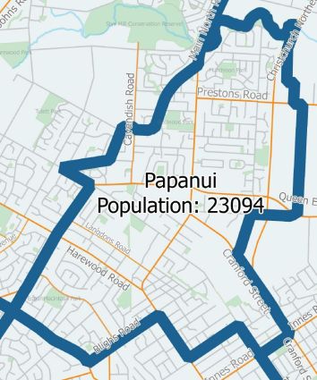
Papanui Ward is described in detail on the Christchurch City Council website. (If you want to check what Ward you live in, you can use the Council’s interactive online map.)
Candidates elected to represent the Papanui Ward in 2019 will be part of the Waipapa/Papanui-Innes Community Board, so will be making decisions across a much larger population and geographic area than just Papanui (link to 2016 map). The Papanui Councillor will also be part of decisions that affect the whole city, or parts other than Papanui.
Ward boundaries change from time to time due to representation review processes, and of course demographics change over time as well – information in this article is current at the time of writing.
Papanui Ward has a higher proportion of people aged 65+ than the city does overall, and a significant number of aged care facilities. There’s also a higher proportion of people aged 0-14 years. The median personal income in Papanui Ward matches the city, but there’s a slightly higher concentration of middle income earners.
A brief tour of Papanui Ward may take in the following:
Papanui
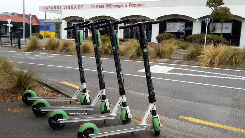 No surprises here. The busy Papanui/Harewood/Main North Rd intersection is near the south boundary of the Ward. The suburb of Papanui is where the Waipapa/Papanui-Innes Community Board regularly meets, in the boardroom at the rear of the library & service centre.
Bryndwr

Wairakei School in Bryndwr is at the south-west corner of Papanui Ward.
St Albans

Across to the east, the Cranford Street / Innes Road intersection in St Albans defines another corner of the Ward.
Casebrook
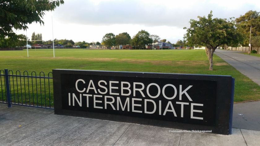
Heading north, Casebrook Intermediate, where I served for eight years as a Board of Trustees member, is part of the Ward, as is the adjacent suburb of Northcote.
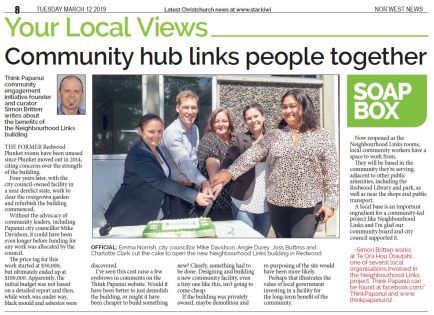
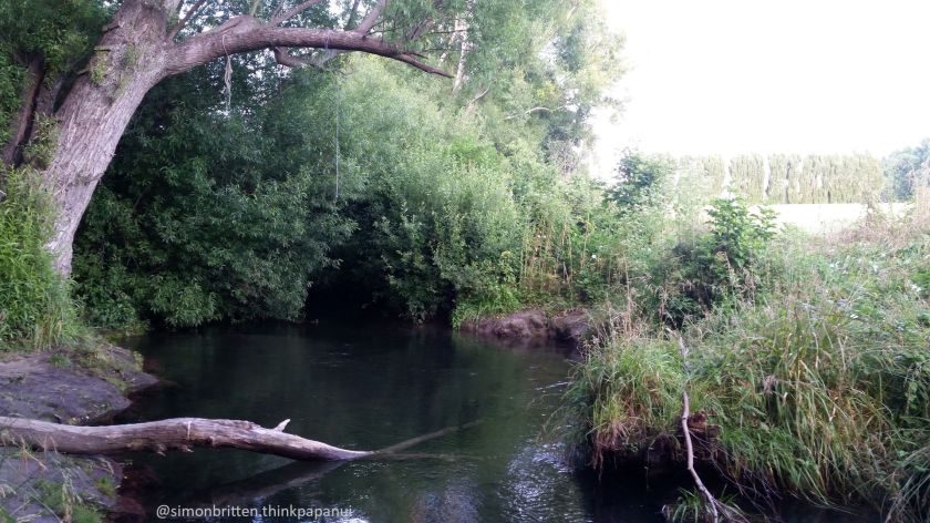
Passing through all of Redwood (home to the newly-opened Neighbourhood Links facility) and Redwood Springs, we reach the Styx River / Puharakekenui, which forms the northern boundary of Papanui Ward.
Question for readers
Is there anything that surprises you about Papanui Ward, or anything you’d like to know?
